Turn map or satellite captures into photoreal oblique aerial views.
What aerial from satellite does
Turn a Google Earth or map capture into a photoreal oblique aerial, drone-style, of the same territory.
Who it is for
Architects, urban designers and developers who need a presentation aerial from a map, without flying a drone.
Credits and how to start
Upload the satellite capture and generate. Each view uses 2 premium credits (AI Pro).
Mix&Design case: from satellite to a sunset aerial
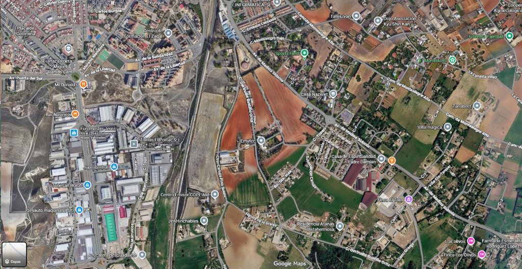
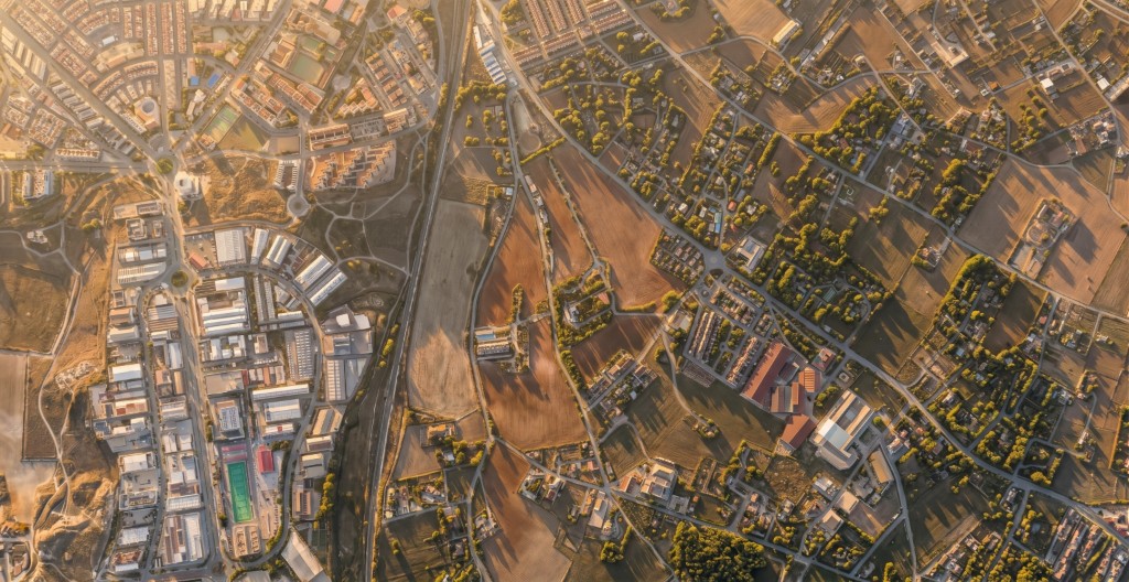
Real project (September 2026). A Google Maps satellite capture (Jerez, Av. de la Solidaridad and fields). Aerial from satellite generated a photoreal oblique at golden hour: the same motorway, industrial estate, fields and hamlet.
24 September 2026 · Mix&Design
Input: satellite capture with labels.Result: photoreal oblique at golden hour.
This is an illustrative view. Sunset light and relief are invented. It does not replace a drone flight or an official orthophoto. Check map labels that should not remain and any invented building.
Frequently asked questions
Is it a real flight?
No. It is an illustration from the map. Light, relief and roof details are invented.
Does it replace an official orthophoto?
No. It is not for measuring or a cadastral file. Review it before client or permit use.
Where do I see pricing?
On /en/pricing: Mix&Design plans and packs.
Next step
Urban space renovation — If you want to propose new buildings or uses on the map, paint zones.
Site & facade — For a line site plan or a facade from Street View.