Mark each zone in a color with the pencil and generate a photoreal aerial of the project.
What urban space renovation does
Upload a map or satellite capture, paint colour zones and describe what should appear in each. The result is a photoreal aerial of the project.
Who it is for
Urban designers, architects and developers testing a plot or land-use hypothesis on a real map.
Credits and how to start
Upload the capture, paint up to four zones, write the prompt for each colour and generate. Uses 3 Premium credits.
Mix&Design case: from farmland to a residential scheme with a pool
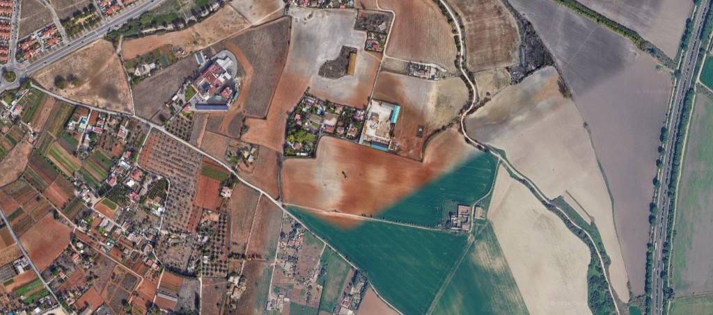
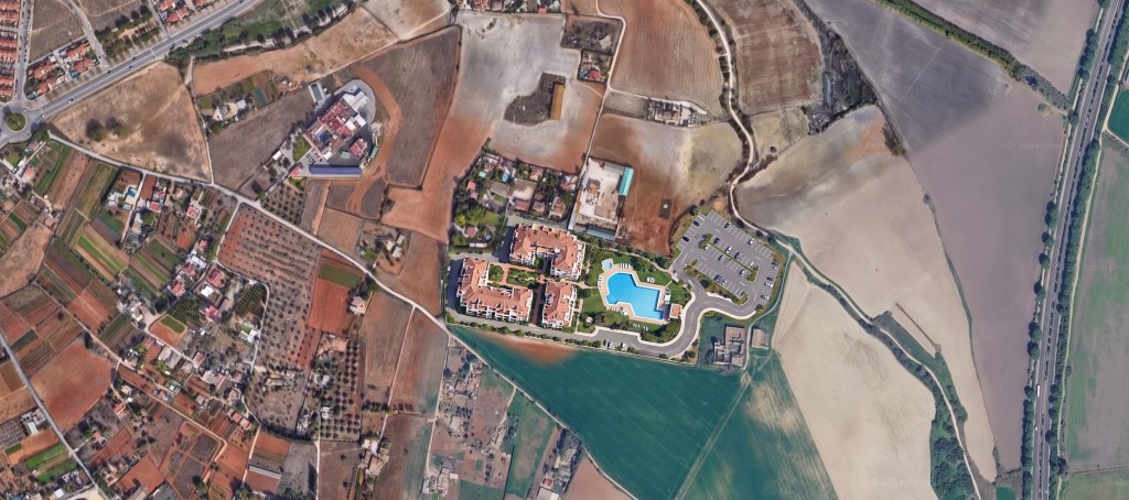
Real project (September 2026). An aerial capture of fields with a marked zone. Urban space renovation previewed a residential cluster with a pool and parking on that plot, keeping paths, olive groves and the motorway.
24 September 2026 · Mix&Design
Input: farmland with a marked zone.Result: residential scheme with a pool on the same plot.
This is a project hypothesis. It is not a planning document or a permit. Check building footprints, roads and any use that was not in the brief.
Frequently asked questions
Do the colour marks stay in the result?
No. Colour only IDs zones. If a fill or a number remains, the image is wrong.
Does it replace a planning document?
No. It is a visual hypothesis. It is not planning or a permit. Check footprints, roads and uses.
Where do I see pricing?
On /en/pricing: Mix&Design packs and all plans.
Next step
Aerial from satellite — If you only want to change the view type, without proposing new buildings.
Site & facade — For the site plan or the facade of the same plot.